Description
A Lidar + RGB Solution for Aerial Surveying
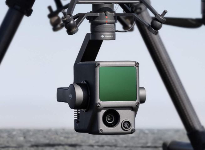
The Zenmuse L1 integrates a Livox Lidar module, a high-accuracy IMU, and a camera with a 1-inch CMOS on a 3-axis stabilized gimbal. When used with Matrice 300 RTK and DJI Terra, the L1 forms a complete solution that gives you real-time 3D data throughout the day, efficiently capturing the details of complex structures and delivering highly accurate reconstructed models.
SPESIFIKASI ZENMUSE L1
- Weight: 900 gram
- IP Rating: IP 44
- Measurement Range: 200m
- Typical Operating Altitude: 50-150m
- Surveying Accuracy: 3cm
- Point Rate: 240,000 points/s (first or strongest return), 480,000 points/s (dual return)
- Scanning Patterns: Melingkar dan linear tidak berulang
- FOV: Circular: FOV 70.4 (Horizontal) x 77.2° (Vertical); Non-Repetitive Linear: FOV 70.4° (Horizontal) x 4.5° (Vertical)
- Returns: 3
- IMU Update Frequency: 200Hz
- Virtual Sensor Effective Pixels: 20mp


